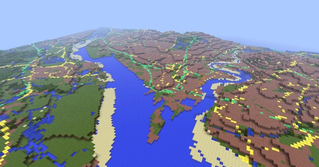
Each block represents ”50 square metres.” They explain their choices in heights for the map as to ‘preserve’ low-lying coastal areas without things getting too out of scale.
The Minecraft map is the result of collaboration with the OS’s Innovation Labs team which dropped a 3D model into the sandbox game. The map is freely available.
”The world consists of more than 22 billion blocks representing over 220,000 square kilometres of mainland Great Britain and surrounding islands. We don’t include Northern Ireland, the Channel Islands or the Isle of Man, because they are mapped by other organisations,” reads the Ordnance Survey website.
”Each blocks represents a ground area of 50 square metres. The raw height data is stored in metres and must be scaled down to fit within the 256 block height limit in Minecraft. A maximum height of 2 500 metres was chosen, which means Ben Nevis, appears just over 128 blocks high. Although this exaggerates the real-world height, it preserves low-lying coastal features such as Bournemouth’s cliffs, adding interest to the landscape.”
”We think we may have created the largest Minecraft world ever built based on real-world data,” said OS Innovation Lab’s Graham Dunlop. ”The resulting map shows the massive potential not just for using Minecraft for computer technology and geography purposes in schools, but also the huge scope of applications for OS OpenData too.”
The Minecraft GB map is 3.6 GB uncompressed and is available here. It was made in two weeks.


